Tanzania Geography
A large central plateau makes up most of the mainland, at between 900 m and 1800 m. The mountain ranges of the Eastern Arc and the Southern and Northern Highlands cut across the country to form part of the Great Rift Valley. The Great Rift Valley stretches north into Kenya as well as can be seen in this Map of Tanzania
A land of geographical extremes, Tanzania houses the highest peak (Mount Kilimanjaro), the lowest point (the lake bed of Lake Tanganyika), and a portion of the largest lake (Lake Victoria, shared with Uganda and Kenya) on the African continent.
Tanzania comprises many lakes, national parks, and Africa's highest point, Mount Kilimanjaro (5,895 m or 19,341 ft). Northeast Tanzania is mountainous, while the central area is part of a large plateau covered in grasslands. The country also contains the southern portion of Lake Victoria on its northern border with Uganda and Kenya.
Administratively, Tanzania is divided into 30 regions, with twenty-five on the mainland, three on Unguja (known informally as Zanzibar Island), and two on Pemba Island.
Physical Geography
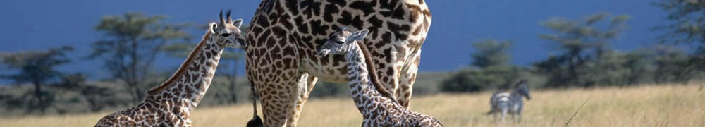
Northeast Tanzania exhibits a mountainous terrain and includes Mount Meru, an active volcano, Mount Kilimanjaro, a dormant volcano, and the Usambara and Pare mountain ranges. Kilimanjaro attracts thousands of tourists each year. West of those mountains is the Gregory Rift, which is the eastern arm of the Great Rift Valley. On the floor of the rift are a number of large salt lakes, including Natron in the north, Manyara in the south, and Eyasi in the southwest. The rift also encompasses the Crater Highlands, which includes the Ngorongoro Conservation Area and the Ngorongoro Crater. Just to the south of Lake Natron is Ol Doinyo Lengai with an elevation of 3,188 m (10,459 ft), the world's only active volcano to produce natrocarbonatite lava. To the west of the Crater Highlands lies Serengeti National Park, which is famous for its lions, leopards, elephants, rhinoceroses, and buffalo plus the annual migration of millions of white bearded wildebeest. Just to the southeast of the park is Olduvai Gorge, where many of the oldest hominid fossils and artifacts have been found.
Further northwest is Lake Victoria on the Kenya�Uganda�Tanzania border. This is the largest lake in Africa by surface area and is traditionally named as the source of the Nile River. Southwest of this, separating Tanzania from the Democratic Republic of the Congo, is Lake Tanganyika. This lake is estimated to be the second deepest lake in the world after Lake Baikal in Siberia. The western portion of the country between Lakes Victoria, Tanganyika, and Malawi consists of flat land that has been categorised by the World Wildlife Fund as part of the Central Zambezian miombo woodlands ecoregion. Just upstream from the Kalambo Falls, there is one of the most important archaeological sites in Africa. Tanzania's Southern Highlands are in the southwestern part of the country, around the northern end of Lake Malawi. Mbeya is the largest city in the Southern Highlands.
The centre of Tanzania is a large plateau, which is part of the East African Plateau. The southern half of this plateau is grassland within the Eastern miombo woodlands ecoregion, the majority of which is covered by the huge Selous National Park. Further north the plateau is arable land and includes the national capital, Dodoma.
The eastern coast contains Tanzania's largest city and former capital, Dar es Salaam. Just north of this city lies the Zanzibar Archipelago, a semi-autonomous territory of Tanzania which is famous for its spices. The coast is home to areas of East African mangroves, mangrove swamps that are an important habitat for wildlife on land and in the water. A recent global remote sensing analysis suggested that there were 1,256km� of tidal flats in Tanzania, making it the 26th ranked country in terms of tidal flat area.
Watersheds
Eastern and central Tanzania are drained by rivers that empty into the Indian Ocean. The major rivers are, from north to south, the Pangani, Wami, Ruvu, Rufiji, Matandu, Mbwemkuru, and the Ruvuma River, which forms the southern border with Mozambique.
Most of Northern Tanzania drains into Lake Victoria, which empties into the Nile River.
The western portion of Tanzania is in the watershed of Lake Tanganyika, which drains into the Congo River. The Malagarasi River is the largest tributary of Lake Tanganyika.
Part of southwestern Tanzania drains into Lake Malawi, which empties south into the Zambezi River.
The Southern Eastern Rift area of north-central Tanzania is made up of several endorheic basins, which have no outlet to the sea and drain into salt and/or alkaline lakes. Lake Rukwa in west-central Tanzania, is another endorheic basin.
Statistics
Location: Eastern Africa, bordering the Indian Ocean, between Kenya and
Mozambique.
Geographic coordinates: 6�00′S 35�00′E
Continent: Africa
Tanzania Area:
total: 947,300 square kilometres (365,800 sq mi)
land: 885,800 square kilometres (342,000 sq mi)
water: 61,500 square kilometres (23,700 sq mi)
Land boundaries:
total: 3,861 kilometres (2,399 mi)
includes the islands of Mafia, Pemba, and Unguja
border countries: Burundi 451 kilometres (280 mi), Kenya 769
kilometres (478 mi), Malawi 475 kilometres (295 mi), Mozambique 756 kilometres
(470 mi), Rwanda 217 kilometres (135 mi), Uganda 396 kilometres (246 mi), Zambia
338 kilometres (210 mi), Democratic Republic of the Congo 459 kilometres (285
mi)
Coastline: 1,424 kilometres (885 mi)
Maritime claims:
exclusive economic zone: 241,888 km2 (93,393 sq mi) and 200 nmi
(370.4 km; 230.2 mi)
territorial sea: 12 nmi (22.2 km; 13.8 mi)
Terrain: plains along coast; central plateau; highlands in north, south
Elevation extremes:
lowest point: Indian Ocean 0 m
highest point: Mount Kilimanjaro 5,895 metres (19,341 ft)
Natural resources: hydropower, tin, phosphates, iron ore, coal, diamonds,
gemstones, gold, natural gas, nickel
Land use:
arable land: 12.25%
permanent crops: 1.79%
other: 85.96% (2011)
Irrigated land: 1,843 square kilometres (712 sq mi) (2003)
Total renewable water resources: 96.27 cubic kilometres (23.10 cu mi) (2011)
Natural hazards:
flooding on the central plateau during the rainy season; drought
volcanism: limited volcano activity; Ol Doinyo Lengai (elevation 2,962 metres
(9,718 ft)) has emitted lava in recent years; other historically active
volcanoes include Kieyo and Meru
Environment - current issues: soil degradation; deforestation; desertification;
destruction of coral reef threatens marine habitats; recent droughts affected
marginal agriculture; wildlife threatened by illegal hunting and trade,
especially for ivory
Statistic reference/courtesy CIA Factbook
Environment - international agreements:
party to:
Biodiversity
United Nations Framework Convention on Climate Change
Kyoto Protocol to the United Nations Framework Convention on Climate Change
United Nations Convention to Combat Desertification in Those Countries
Experiencing Serious Drought and/or Desertification, Particularly in Africa
Convention on International Trade in Endangered Species of Wild Fauna and Flora
Basel Convention on the Control of Transboundary Movements of Hazardous Wastes
and Their Disposal
United Nations Convention on the Law of the Sea
Vienna Convention for the Protection of the Ozone Layer
Convention on Wetlands of International Importance, especially as Waterfowl
Habitat
Specific geographic regions
Menai Bay Conservation Area
Mount Kilimanjaro
Mount Meru
Olduvai Gorge
Umba Valley
Exotic Dubai Tours Tour and Safaris in Dubai | Exotic Abu Dhabi
Links to Tanzania Web Sites | RAIN QUEEN MODJADJI | THE AFRICAN CAPE ELAND